Get Lot Surveying in Oakland County, MI
Lot surveying services for Oakland County property owners identify boundaries, resolve property disputes, and support development projects such as new constructions and land divisions.
Lot surveying services are essential for property owners in Oakland County, MI who want to ensure their land boundaries are accurately defined. Accurate boundary identification helps prevent future disputes, supports proper property development, and ensures compliance with local regulations. By working with experienced surveyors, property owners can gain clarity on their land’s exact limits, which is crucial for planning improvements, fencing, or new construction projects, providing peace of mind and reducing potential legal issues.
In addition to boundary accuracy, lot surveying offers benefits that enhance the overall safety, functionality, and curb appeal of a property. Precise surveys help identify existing features and potential obstacles, aiding in landscape design and construction planning. They also contribute to long-term durability by preventing encroachments and ensuring structures are built within the correct boundaries, ultimately reducing maintenance needs and enhancing the property's visual appeal. Engaging professional surveyors provides a reliable foundation for maintaining a well-defined and attractive property.
- Boundary Establishment - needed when property lines are unclear or disputed in residential or commercial areas.
- Subdivision Planning - required during land development to accurately divide large parcels into smaller lots.
- Construction Staking - essential for precise placement of structures during new building projects.
- Topographic Surveys - used for projects that require detailed land elevation data, such as grading or landscaping.
- Easement and Right-of-Way Surveys - necessary when establishing access rights or utility placements across properties.

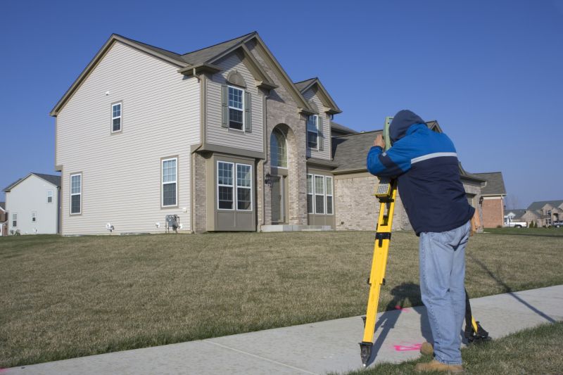

Lot surveying services involve the precise measurement and mapping of land parcels to establish property boundaries and features. These surveys typically include determining the exact location of property lines, identifying existing structures, and creating detailed maps or plats. Such services are essential for ensuring legal clarity regarding property ownership, resolving boundary disputes, and providing accurate information for development or subdivision projects. By utilizing specialized tools and techniques, surveyors can produce reliable data that forms the foundation for many land-related decisions.
These services help address common problems such as boundary disagreements, encroachments, and property line ambiguities. When property owners or developers face disputes over land limits, a professional survey can clarify the exact boundaries and prevent future conflicts. Additionally, lot surveys are often required before purchasing land, building new structures, or dividing parcels for sale or development. Accurate land data can also assist in planning construction projects, ensuring structures are positioned correctly and comply with local zoning regulations.
Lot surveying services are typically used for a variety of property types, including residential subdivisions, commercial developments, agricultural land, and vacant lots. Residential properties often require surveys before new construction, additions, or boundary adjustments. Commercial properties, such as retail centers or office complexes, rely on precise surveys for site planning and legal documentation. Agricultural landowners may also utilize these services to delineate farm boundaries or prepare for land transfers, ensuring clarity and compliance with local land use requirements.
Engaging with local land surveyors or property service providers can help property owners and developers obtain accurate land measurements and boundary delineations. These professionals use advanced measurement techniques and mapping tools to produce detailed survey reports suited for various land-related needs. Whether for resolving boundary issues, planning new construction, or verifying property limits, lot surveying services provide the reliable data necessary for informed land management and development decisions.
The overview below groups typical Lot Surveying projects into broad ranges so you can see how smaller, mid-sized, and larger jobs often compare in Oakland County, MI.
In many markets, a large share of routine jobs stays in the lower and middle ranges, while only a smaller percentage of projects moves into the highest bands when the work is more complex or site conditions are harder than average.
Survey Costs - The cost for lot surveying services typically ranges from $300 to $1,000, depending on the size and complexity of the property. Smaller parcels may be on the lower end, while larger or more detailed surveys can cost more. Local pros can provide specific estimates based on individual property needs.
Per Acre Pricing - For larger parcels, survey costs often are calculated per acre, with prices generally between $500 and $2,000 per acre. The total expense varies with the terrain, access, and survey type required. Contact local service providers for precise quotes tailored to specific land sizes.
Boundary Survey Fees - Boundary surveys usually cost between $400 and $1,200, with factors such as property size and survey detail influencing the price. More intricate boundary determinations or disputed lines may increase the overall cost. Local surveyors can offer detailed estimates for these services.
Additional Service Charges - Additional services like topographic surveys or construction staking may add to the overall cost, often ranging from $200 to $800 extra. The final price depends on the scope of work and property specifics. Local professionals can help determine the exact costs for these supplementary services.
Actual totals will depend on details like access to the work area, the scope of the project, and the materials selected, so use these as general starting points rather than exact figures.
Boundary Line Surveys - Local surveyors provide precise boundary measurements to establish property lines for land development or dispute resolution.
Topographic Surveys - Service providers create detailed maps of land features, aiding in planning and construction projects in Oakland County and nearby areas.
ALTA/NSPS Land Title Surveys - These comprehensive surveys assist in title insurance and real estate transactions by providing detailed property data.
Subdivision Surveys - Local pros help divide larger parcels into smaller lots, supporting residential and commercial development efforts.
Construction Staking - Surveyors mark out building locations and elevations to guide construction projects accurately on-site.
Floodplain Surveys - Service providers assess land to determine flood risk and ensure compliance with local regulations for property development.

When choosing a professional for lot surveying services, it’s important to evaluate their experience in the field. Homeowners should look for local pros who have a proven track record of completing similar projects in Oakland County and nearby areas. Experienced surveyors are more likely to understand local regulations, terrain challenges, and property nuances, which can contribute to accurate and reliable results.
Clear communication and well-defined expectations are essential when working with a lot surveying contractor. Homeowners should seek professionals who provide written estimates or scope of work, outlining the services offered and any relevant details. This helps ensure that both parties have a mutual understanding of the project’s scope, reducing potential misunderstandings or surprises during the process.
Reputable references and reviews from previous clients can offer valuable insights into a surveyor’s reliability and professionalism. Homeowners are encouraged to ask for references or look for local reviews to gauge the quality of work and customer satisfaction. Additionally, establishing open lines of communication with the pros ensures that questions or concerns can be addressed promptly, fostering a smoother working relationship throughout the surveying process.
Property owners in Oakland County, MI use Lot Surveying services for practical projects around their homes and businesses. The sections below highlight everyday jobs and straightforward project options.

Lot surveying services are commonly needed for various property-related projects in Oakland County, MI. Property owners may seek a survey to establish property boundaries before purchasing land, resolving boundary disputes, or planning construction projects such as home additions or new structures. Accurate land measurements help ensure that improvements are within property lines and comply with local regulations, reducing potential conflicts with neighbors or city authorities.
Additionally, lot surveys are useful when preparing for land development or subdivision, ensuring that plans are based on precise measurements. Property owners might also request surveys for estate planning, to confirm the exact size of their lot, or to identify easements and encroachments that could affect future property use. Connecting with experienced local surveyors can help property owners address these needs efficiently and accurately.
What is lot surveying? Lot surveying involves measuring and mapping land parcels to determine boundaries, size, and features for property development or ownership clarification.
Why is a land survey important before construction? A land survey helps identify property boundaries and existing features, reducing the risk of boundary disputes and ensuring compliance with local regulations.
How long does a typical lot survey take? The duration of a lot survey varies depending on property size and complexity, with local surveyors providing estimated timeframes upon request.
What information is needed to schedule a lot survey? Details such as property address, parcel number, and any existing survey documents are typically required when contacting local survey providers.
How do I find qualified land surveyors in Oakland County, MI? Contacting local land surveying service providers in Oakland County can connect property owners with experienced professionals for their land measurement needs.
Boundary and Title Surveys - Professionals can determine property boundaries and prepare accurate title surveys to support legal and development needs.
Topographic Surveys - Local surveyors create detailed topographic maps to assist with site planning and construction projects.
Subdivision Surveys - Experts facilitate land subdivision processes by providing precise surveys that meet local regulations.
Construction Staking - Surveyors mark out building locations and alignments to ensure construction projects follow approved plans.
Considering Lot Surveying for a property in Oakland County, MI? The sections above highlight common project types, practical options, and details that often shape the scope of work.
When you are ready, use the quote form to share a few details about your project. Local pros can review the basics and respond with options that match what you have in mind.